|
设计简介 |
文档包括:
计算说明书一份,58页,约72000字
设计说明书一份 ,63页,约36000字
CAD版本图纸共5张
摘 要
林江是我国大河流之一 ,其干流全长700公里,流域面积17400平方公里;楚河是林江的重要支流,流经林江的上下游地带,全长250公里,流域的面积为7200平方公里。楚河开发计划是配合林江而制定的。楚河楚林水利枢纽就建立在楚河和林江汇流处的楚林。
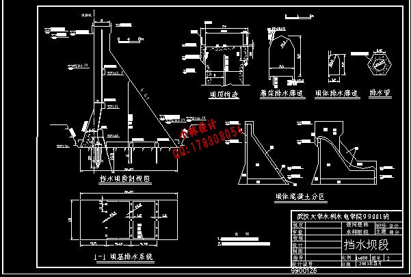
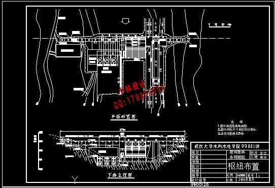
枢纽属一等工程,以防洪和发电为主,兼有航运等综合效益。其主要建筑物有:混凝土实心重力坝、引水建筑物、泄洪建筑物、放空建筑物、过坝建筑物和电站厂房等
枢纽按千年一遇洪水设计,五千年一遇洪水校核。水库正常蓄水位178.0米,设计洪水位179.3米,校核洪水位180.13米。电站装机3台2.4万千瓦,总装机72000千瓦。船闸可以保证80吨级驳船通航。
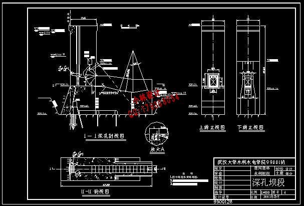
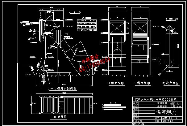
主体建筑物实体重力坝坝顶高程182.04米,最大坝高46.04米;泄洪采用表孔,共三孔,每孔宽12米,堰顶高程170.92米;放空采用深孔,设一孔,宽3.5米,高4米,底板高程151米;电站引水采用坝内压力钢管,钢管直径4.5米;电站厂房为坝后式。
本设计对枢纽的主体建筑物进行了认真的方案比选和详细的尺寸设计,并对所设计的建筑物进行了安全校核,保证建筑物的安全运行。同时对水电站和施工导流进行了简要的设计。
[关键词]林江 楚河 楚林 水利枢纽 大坝
Abstract
Linjiang River is one of the large stream flow in our country, which has 700 kilometers long, and drainage area covers about 174000 km2. Chuhe River, which is on the upstream of the Linjiang River, is the most important anabranch on the Linjiang River, it has 500 kilometers long and it’s drainage area covers 7200 km2. The development plan of Chuhe River is determined on the Linjiang River. The Chuhe Chulin water project plan is built at the Chulin, of which the accordant junction of Chuhe River and Linjiang River.
The Chuhe Chulin water project plan is the first class project, it’s main functions are flood control and power generation. The main building includes: the concrete gravity dam, the diversion head building, the emptying outlet building and water power plant etc.
Water project plan is designed according to meeting flood design once in millennium, and meet flood check once in five thousand years. The normal water level of the project is 178.0m, the design flood level is 179.3m, and the check flood level is 180.13m.The total volume of the power generation units is 72000KW. The ship box can guarantee that 80 tons of barges get through.
This design has compared several available projects earnestly and design detailed size. At the same time it checks the safety, and ensure the safe operation of the building. Simultaneously, the paper design the water power station and diversion work briefly.
[Keywords] Linjiang River Chuhe River Water project plan Dam
目 录
第一章 总述 1
第二章 基本资料 2
2.1 坝址地形 2
2.2 坝址地质 2
2.3 水文气象 2
2.4 当地材料分布情况 4
2.5 交通运输情况及施工条件 4
2.6 水利水能计算资料 4
2.7 船闸设计资料 5
第三章 坝型选择与主要建筑物的选择 6
3.1 确定枢纽等别和建筑物的级别 6
3.2 坝型的选择 6
3.3 枢纽主要建筑物的选择 8
第四章 调洪演算 11
4.1调洪演算的目的、基本原理及方法 11
4.2 调洪演算方案及成果 11
第五章 枢纽布置 13
5.1 枢纽布置的基本原则 13
5.2 枢纽布置方案比选 13
5.3 枢纽的进一步布置 13
第六章 挡水建筑物设计 15
6.1 挡水建筑物形式的选择 15
6.2 剖面尺寸设计 15
6.3 坝体经济剖面选择 16
6.4 稳定及应力分析(手算) 17
6.5 稳定及应力分析(电算) 19
第七章 泄水建筑物的设计 22
7.1 泄水建筑物形式的选择 22
7.2 溢流坝剖面设计 22
7.3闸门、闸墩及导墙设计 25
7.4 稳定与应力分析(电算) 28
第八章 放空建筑物设计 31
8.1 深孔的作用 31
8.2 深孔形式的选择 31
8.3 基本尺寸初拟 31
8.4 深孔体型设计 31
8.5 深孔其他设施设计 34
第九章 电站坝段设计 36
9.1 电站布置形式的选择 36
9.2 基本尺寸拟订 36
9.3 深式进水口体型设计 37
9.4 坝内钢管的布置 39
9.5 其他设施设计 40
第十章 通航建筑物设计 41
10.1 通航建筑物形式的选择 41
10.2 船闸的选型 41
10.3 船闸基本尺寸设计 41
10.4 船闸在枢纽中的布置 42
第十一章 细部构造设计 43
11.1 坝顶构造 43
11.2 坝体分缝及止水 44
11.3 廊道系统 45
11.4 坝体排水 47
11.5 坝体材料分区 47
第十二章 基础处理 49
12.1 地基开挖与清理 49
12.2 固结灌浆 49
12.3 帷幕灌浆 50
12.4 坝基排水 51
第十三章 施工导流设计 53
13.1导流方案选择 53
13.2导流方案 54
13.3导流设计流量确定 54
13.4围堰工程 55
附 录 坝址处流量-水位关系 57
|


